Discover Wild British Columbia
Find the best free camping spots and outdoor activities on BC crown land
Explore Map Which land is which?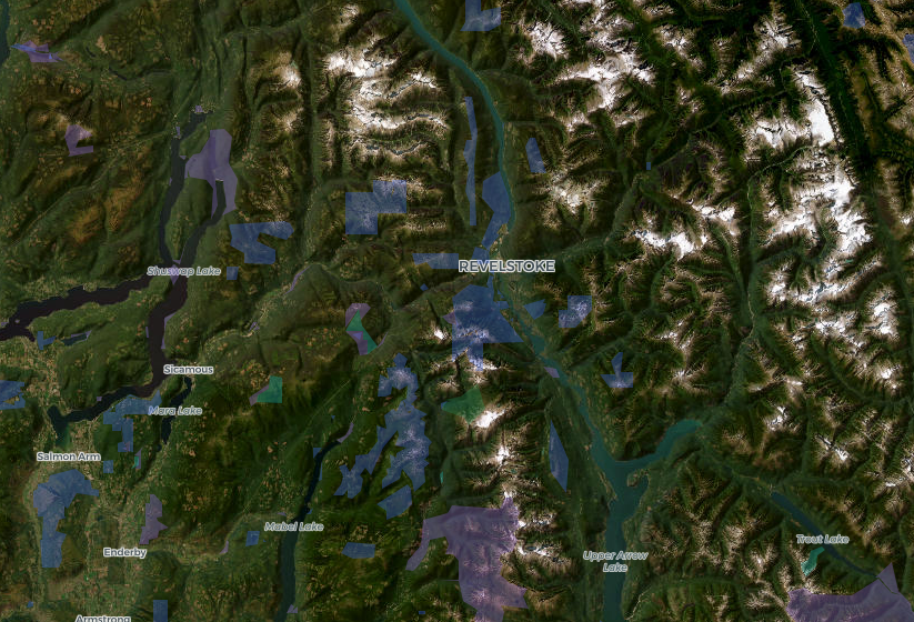
Reading the British Columbia map
The map shows BC Parks boundaries and Recreation Sites and Trails BC polygons. Plain Crown land is the unshaded background, but private land, reserves, treaty lands and Wildlife Management Areas are unshaded too, so a blank spot near a town is not automatically open. How to confirm a spot
Crown land in British Columbia: what you need to know
Most of the province is public, but not the parts by the highway
About 94% of British Columbia is provincial Crown land. The private 5% is concentrated where people live and drive: the Lower Mainland and Fraser Valley, the Okanagan benches, the Peace farmland, valley bottoms through the Interior, and a large block of private forest on eastern Vancouver Island. That's why a lakeshore beside the highway is often private while the same lake's far side, up a forest road, is Crown land. Our Crown land by city pages show what's realistically within reach of each town.
The 14-day rule
BC sets out Crown land camping in a provincial policy called the Permission. Anyone, resident or visitor, may camp on Crown land for up to 14 consecutive days at a site. The count only resets if you, your vehicle and your gear are gone for 72 hours straight. The Permission doesn't apply in parks, ecological reserves, conservancies, Wildlife Management Areas, municipalities, leases or federal land, or anywhere posted against camping. Leave no structures and no garbage. The Crown land camping rules guide covers all of it, including how fire bans work.
Fire bans move fast
Campfires up to half a metre high and wide are "Category 1" fires, and in most summers at least one fire centre bans them. Bans are set by fire centre and sometimes by zone, so the rule at your camp may differ from the rule in town. Check the BC Wildfire Service's current restrictions the day you leave, and report a wildfire at 1-800-663-5555 or *5555.
Recreation sites, parks and the rest of the map
Blue on the map marks Recreation Sites and Trails BC's rustic Crown land campsites: tables, fire rings and a pit toilet on a lake or river, some free and some with a nightly fee. Purple is BC Parks, where you camp only in campgrounds or where a park allows backcountry camping. Since 2026, visitors from outside BC pay an extra $20 non-resident fee wherever a park camping fee applies. Teal ecological reserves are off-limits to camping, hunting and fishing. The guide to parks, protected areas and rec sites lays out the differences.
Before you go
Unshaded land on the map is usually Crown land in the backcountry but often private near towns, and reserves, treaty lands and private forest aren't shaded at all. Our how to find Crown land guide walks through the official tools. Anglers 16 and older need a freshwater licence, and barbed hooks are banned in all BC rivers and streams; see the fishing licence and rules guide. Hunters start with hunting on Crown land. Non-residents need a licensed guide for big game.
British Columbia guides
The 14-day camping rule, fire bans, freshwater licences, hunting and land designations in BC, each checked against the provincial source it links to.
Explore British Columbia
Crown land by region
Crown land near a town
Campgrounds by region
- Vancouver Island
- Vancouver Coast and Mountains
- Thompson Okanagan
- Kootenay Rockies
- Cariboo Chilcotin Coast
- Northern British Columbia
All BC campgrounds and recreation sites
Lakes and road trips
BorealMaps: the app that reads your geo-referenced PDF maps
Export a map here, open it in BorealMaps on your phone, and your GPS position shows up right on it — with no cell signal at all.

Plan Your Next Road Trip
The Itinerary Planner lets you draw any route on the map, split it into segments, and instantly generate offline-ready geo-referenced PDF maps for every leg of your journey.
Try the Itinerary PlannerDownload PDF
Generate geo-referenced PDF maps with your selected areas and custom markers for offline use.
About See plans