Discover Wild Ontario
Find the best free camping spots and outdoor activities on Ontario crown land
Explore Map Read the camping rules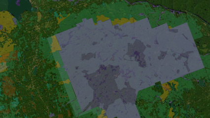
What the map colours mean
The Ontario layer is the province's Crown Land Use Policy Atlas. Each colour is a land-use designation with its own rules. How the land types differ
Crown land in Ontario: what you need to know
Ontario has more accessible public land than most people who live here realise, and most of it can be camped on for nothing. It also has a set of rules and a land-status system that trip up first-timers every summer. Here is the short version.
Who can camp for free, and for how long
If you are a Canadian resident, you can camp free on most Crown land in Ontario, including Crown land covered by water, for up to 21 days on any one site in a calendar year. After 21 days you have to move at least 100 metres. Most non-residents of Canada need a Crown land camping permit to camp north of the French and Mattawa Rivers, currently priced per person per night, with exemptions for people under 18, Ontario property owners and a few other cases. The current fee and the full list of exemptions are on ontario.ca's Crown land camping page. Our Crown land camping rules guide walks through the details, including fires, garbage and what "site" means in practice.
Where Crown land actually is
The province says Crown land represents 87% of Ontario, but that figure hides a sharp split. South of the French River and Mattawa line, and especially south of the Shield, most land was patented to settlers generations ago and is now private. What is left is scattered: pockets around Bancroft, Haliburton and the Madawaska Valley, small blocks in Land O'Lakes and the Kawarthas. North of that line the picture flips, and from Sudbury and North Bay up through Temagami, Chapleau, Thunder Bay and Kenora, Crown land is the default and private land is the exception. If you are starting from a city, the Crown land near your city pages show what is realistically within a drive, and how to find Crown land explains how to read the map layers once you get there.
Parks, reserves and Crown land are not the same thing
Provincial parks and conservation reserves sit on Crown land, but they are managed under their own legislation and their own rules. In a park you book and pay for a site, and backcountry camping needs a permit. In a conservation reserve, camping may be allowed but activities are more restricted and vehicle access is often limited. On general-use Crown land, the free-camping rules above apply. The map colours these differently for exactly this reason, and it is worth knowing which one you are looking at before you drive three hours. Our Crown land vs parks and reserves guide lays out the differences, using places like Algonquin and the Crown land around its edges as examples.
Before you go: confirm the designation
Our map shows Crown Land Use Policy Atlas designations, which are policy areas rather than surveyed lot lines. Private lots, mining claims, leases and reserve lands can exist inside an area shown as general use. So use the map to narrow down a region, then confirm the specific spot in the Policy Atlas, check with the local MNRF district office if the status is unclear, and obey signs on the ground. The same applies to fishing and hunting: the map tells you where you can probably stand, but the fishing licence and zones guide and the hunting on Crown land guide cover what you need in hand once you are there.
Ontario guides
Plain-English explanations of the rules, each with links to the official source so you can check the current version.
Browse Ontario
Crown land by region
Crown land near a city
Campgrounds by region
- Southwest Ontario
- Niagara Falls and Wine Country
- Hamilton, Halton and Brant
- Huron, Perth, Waterloo and Wellington
- Greater Toronto Area
- Bruce, Grey and Simcoe
- Kawartha and Northumberland
- South Eastern Ontario
- Ottawa and Countryside
- Haliburton Highlands to the Ottawa Valley
- Muskoka, Parry Sound and Algonquin Park
- North East
- North Central
- North West
Ontario Crown Land
Ontario crown land covers more than 937,000 square kilometres — roughly 87% of the province — spanning boreal forest, Canadian Shield wilderness, wetlands and river systems. Managed by the Ministry of Natural Resources and Forestry, most crown land is open for free camping (21-day limit per site), hunting, fishing and off-highway vehicle use. Northern and near-north Ontario in particular offers some of Canada's finest wilderness canoe routes, trophy fishing lakes and hunting territories.
AboutBorealMaps: the app that reads your geo-referenced PDF maps
Export a map here, open it in BorealMaps on your phone, and your GPS position shows up right on it — with no cell signal at all.

Plan Your Next Road Trip
The Itinerary Planner lets you draw any route on the map, split it into segments, and instantly generate offline-ready geo-referenced PDF maps for every leg of your journey.
Try the Itinerary PlannerDownload PDF
Generate geo-referenced PDF maps with your selected areas and custom markers for offline use.
How geo-referenced PDF maps work See plans